Blog Archives

Tuff Cones

Posted on by Josh Packer / Leave a comment

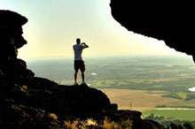
I guess you could say I’ve never been much of an explorer, at least in the traditional sense of the word. I do like to explore new experiences on my own, such as creating a home network, troubleshooting IT issues, or developing new photography techniques through watching YouTube videos and then practicing.

But sadly, even though I’ve lived in Idaho pretty much my entire life, I never really got into being outdoors. Don’t get me wrong—I love the smell of a campfire, or the aroma in the woods after a rainstorm. It’s just that hiking was never fun to me. Before I took up photographing Idaho as a hobby, I actually dreaded hikes, which struck me as tedious. But now I enjoy capturing the beauty of, say, a hike in the Driggs area, or a climb up Menan Buttes. Lately, I’ve come to regard each new outing as another opportunity to explore my home state.

Continue reading

This content is available for purchase. Please select from available options.
Register & Purchase  Purchase Only

A Hole in the Boat

Posted on by Cheryl Cox / Leave a comment

Despite the cold wind at the edge of his redwood deck, Shannon Hansen carefully places rib-eye steaks on a grill.

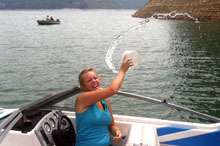
Inside, his wife Jill has set a large table, her kitchen counter already covered with potluck contributions. Eagerly accepting the steaming mug Jill offers, I take an appetizer before blending into the group of family and friends who have gathered at the Hansens’ house for a lively battle against the monotony of gray days. By the time Shannon comes inside and closes the sliding door behind him, we are discussing winter water levels and warm summer days at Palisades Reservoir, which lies about fifty-five miles southeast of Idaho Falls.

“I nearly sank the boat last year,” he announces, catching me mid-bite. He launches into a narrative that will quickly become a local classic. With my addition of a few historical notes for clarity, this is his tale:

Shannon pulls his pickup off U.S. Highway 26, careful to clear his boat and trailer as he enters the scenic overlook at Calamity Point. Here, in 1957, the Bureau of Reclamation completed a project envisioned in the late 1940s to construct a massive earthen dam across a narrow reach of the Snake River Canyon. The dam, the largest of its kind in Idaho, impounded the river, flooded the canyon, and backfilled drainages until more than a million acre-feet of water storage capacity reached as far as the Wyoming state line near Alpine, eleven miles upriver.

All this was good news for irrigators and hydroelectric power producers, but even better news for recreationists. Arguably the project’s most enthusiastic stakeholders, the Palisades Reservoir could offer a gamut of close-to-home water sports never before available on such a scale.

Shutting down his pickup, Shannon drops the ignition key onto the center console. The familiar clatter triggers seatbelts and locks. When doors fly open, his family, eager to stretch cramped legs after the drive up from Rigby, spills out onto the asphalt. Bringing up the rear, a gangly retriever coming to terms with his long legs joins the group at the overlook’s edge. Continue reading

This content is available for purchase. Please select from available options.
Register & Purchase  Purchase Only

High Anxiety

Posted on by Mike Cothern / Leave a comment

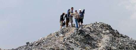
As the phone conversation ended, a wave of anxiety washed over me. Did I really want to climb two of Idaho’s tallest mountains with a group of strangers?

I had once made it to the top of Mount Borah, but that was almost a decade ago. Since then, my body had suffered more wear and tear, and I was sure my tolerance had lessened for exposure to weather at high elevations.

The offer to accompany an informal hiking group, most of whose members called the Magic Valley home, was my own fault. Earlier in the year, I had talked to Norman Wright, a Filer resident, about a potential trip. He organizes several outings annually that include ascending at least one of the state’s highest mountains. My initial desire to bag another Idaho peak waned as the spring unfolded into summer, but even so, I phoned him again, part of me hoping I had missed the opportunity.

Norman said my timing was perfect. “We’re headed to climb Mount Church and Mount Donaldson next Saturday. We’ll have the rare chance to summit two twelve-thousand-footers in one day.”

I cautioned him that I didn’t want to attempt anything beyond my ability, but after he heard about my Borah trek, his enthusiasm held steady. “There are a couple of tough spots, but you’ll be fine.”

That evening I opened the definitive book on the state’s high elevations, Exploring Idaho’s Mountains: A Guide for Climbers, Scramblers, and Hikers, by Tom Lopez. Reading that the author rated the climb we would make as one level more difficult than Borah, I groaned. Ten years ago, Chicken Out Ridge on Borah had seemed to be at the edge of my abilities—could I take on something more than that now? The doubts began adding up, and my heart throbbed faster, reminding me of my not-quite-prime physical condition. Not wanting to waste a quickened pulse (or perhaps to mask it), I hopped on the treadmill. Could I get into any kind of decent shape in ten days?

Every night, I doggedly did time on the machine. I wasn’t sure if my cardiovascular condition improved much, but was comforted to find that the exertion on my heart and lungs didn’t cause them to fail. Other parts of my body clearly were not happy. My arthritic hip joints, one of which was replaced a year after the Borah summit, whined for less abuse and more acetaminophen. My back felt out of alignment, requiring a crack by my chiropractor.
Continue reading

This content is available for purchase. Please select from available options.
Register & Purchase  Purchase Only

Or Not to Ski

Posted on by Michael Stubbs / Leave a comment

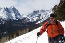
When I backpacked thirty miles through the rough and rocky Sawtooth Range in July 2013, I met many people, from England, Oregon, Connecticut, and elsewhere. Last February, when I dragged the same backpack on a sled over a snowpack eight feet deep, I saw none of these people.

I didn’t even see the mountains. They were veiled in cloud. The only person I saw was my friend Will, whom I had convinced that skiing to Idaho’s Imogene Lake via the Hell Roaring Creek trail in winter was a good idea. Will had shared my summer view of this coldwater lake, which reflects the crumbling granite of the serrated Sawtooth peaks reaching all around to ten thousand feet. I had convinced both of us that the quiet beauty and isolation of the high mountain valley could be even better experienced in winter­­­—and maybe we would even see wolves. But that wasn’t how it worked out.

Perhaps we just picked the wrong weekend. The weather worked against us. The larger Sawtooth Valley, so reliably cold through most of the winter, was experiencing a warm spell. The snow that had fallen for two days before we arrived was slushy, thanks to the weather phenomenon known as the Pineapple Express. Our skis sank eight to ten inches with each forward kick. The lead skier carved a deep trough for the man who followed. Neither breaking trail nor following was easy. I had to shorten my ski poles to match the new difference in height between the trough that I stood in and the snow at my sides. And when I stepped out of my skis to adjust my gear, I sank past my waist and floundered desperately in wet snow. Continue reading

This content is available for purchase. Please select from available options.
Register & Purchase  Purchase Only

Standing on the Snake

Posted on by Mark Weber / Leave a comment

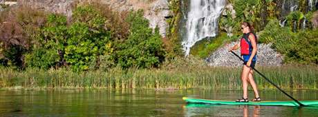
On the river, we dip our paddles into the reservoir’s slack water and head upstream into a stiff breeze. We make good progress on our standup paddleboards (SUPs) and soon leave powerboats and fishermen behind. The canyon walls narrow and become steeper as the calm water gives way to the river current once again. On our left, a hundred-foot-tall waterfall pours over the canyon’s rim. Ahead of us lies a bizarre landscape of sculpted and bleached white rock. Because it’s late summer and a dry year, the once mighty Snake River has been lowered by irrigation, reduced to a serpentine channel carved into the bedrock of the canyon. Still paddling upstream, we navigate the channel, which is barely ten feet across in places. Springs feed small cascades that spill over the rock walls and into the river. Finally, the river becomes so constricted that we pull the SUPs onto dry bedrock and consider our options.

As a photographer with an appreciation for adventure and nature, I spend much of my time exploring Idaho’s outdoor and recreational opportunities. Last year, as summer was quickly drawing to a close, I wanted to take advantage of one more weekend of warm weather. Figuring a river adventure would be a fitting close to the season, I made a couple of calls, to my son Elijah and daughter Jessica. They were eager for an adventure and we agreed to explore the Snake River on SUPs. Our plan was to paddle thirty to forty miles of the Snake in south-central Idaho while visiting some of the more iconic attractions along its course. Continue reading

This content is available for purchase. Please select from available options.
Register & Purchase  Purchase Only

The “23”

Posted on by Will Edwinson / Leave a comment

What made this part of Black Canyon unique was the canyon bottom. Standing at the rim of the canyon wall a hundred feet above the river, one could view a piece of God’s artwork at its best. The canyon bottom was formed by molten lava that had flowed, and later hardened, to form a flat surface similar to that of a giant patio. This patio-like canyon floor was approximately a mile and half long and five to six hundred feet wide. Scattered along this giant patio were several large holes that made up the various pools of water where Buddy and his friends enjoyed swimming. They varied in size from twenty-five to forty feet across.

There was a larger pool just down river from the 23 called the “60,” and though the boys swam there also, the 23 was still favored because it was somewhat smaller, which enabled the sun to heat the water to a warmer temperature. Because the water flowed so slowly through this section of Black Canyon, it was nearly stagnant. Not so stagnant that it became foul, but stagnant enough that the sun was able to heat some of the pools to a near tepid state.

Buddy was standing waist deep in the pool on a rock ledge about three feet below the surface of the water. It was about thirty feet across the pool and Buddy wondered if he could make it to the other side. He had mastered the dog paddle pretty well, but he had only dared venture a few feet from the safe haven of the edge of the pool. Although he felt he was ready, he had never mustered the courage to attempt a crossing. Today, he thought, is the day I should try it. Continue reading

Thirty-Six Hours in Idaho

Posted on by Brendan Leonard / Leave a comment

Most Idaho travel brochures won’t tell you that in just two days’ time you can see lava that came from thousands of feet beneath the surface of the earth, a legendary writer’s last resting place six feet beneath the earth, and stand 12,662 feet above the earth. But that’s just what my friend Tim and I set out to do last July.

I had spent most of my summer working at the Post Register in Idaho Falls. Although my internship had lasted three months, I didn’t feel that I knew any more about Idaho than before I came. (Though I could find Rexburg, INEEL and Blackfoot on a map).

Tim and I had two days to see Idaho, so we left Idaho Falls on a sunny Wednesday, shooting west down Highway 20. First stop, Craters of the Moon National Monument.

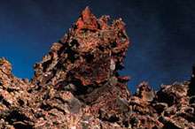
We turned off the highway and followed the loop that cuts through the monument. I tried to keep my eyes on the road but ended up staring out the window at the endless lava fields peppered with sagebrush.

The name “Craters of the Moon” was no coincidence. The entire preserve actually looked like the surface of a barren planet. It was a strange sight in the middle of scenic Idaho, a state I thought was famous for its mountains, valleys, streams, and lakes, not a giant magma wasteland.
Tim and I hopped out of the car at the foot of Big Cinder, the monument’s largest volcanic cone. We crunched our way up the massive black mound and I remembered my high school track days, running hundred-meter dashes on cinder tracks.

“You know, if you jump up and down on this stuff, it feels exactly like jumping on snow,” Tim said, snapping photos of the landscape.
“Yeah?” I said. I immediately began hopping and stomping like I hadn’t done since I was ten years old. It didn’t feel like snow, but there was an odd bounce to it, pushing me back up when I landed. Up and down, up and down, bouncing until I felt embarrassed.
We stood at the top of Big Cinder and gazed over the scenery below: brown and black lava fields and cinder spread over the land where the greens and browns of grasslands should have been. I thought I knew what natural beauty was—the rugged upward juts of mountains, ocean waters rolling on the horizon, the dramatic curves and drops of canyons and gorges. Craters of the Moon was just, well, beautifully strange.
I wasn’t the only one to think so. In the 1924 presidential proclamation that established it as a national monument, Craters of the Moon was called a “weird and scenic landscape peculiar to itself.”

Considering it was midweek, I was surprised to see several other visitors at the monument, driving around the loop and hiking up the cinder cones.

“Most of our visitors are just passing through,” Jim Morris, Craters of the Moon superintendent, says. “We’re between Yellowstone National Park and the Sawtooth Recreation Area. People pick Yellowstone as a destination vacation spot, and they’ll stop here on their way through.”
Two hundred thousand visitors stop at Craters of the Moon every year, and Morris estimates sixty percent of them don’t pick the monument as their “destination” spot.

Tim and I didn’t either. We hopped back in the car and took off down Highway 20 again. Next stop, Ketchum.

When we arrived in Ketchum’s surprisingly cosmopolitan downtown we were instantly surrounded by luxury SUVs and the summer resort crowd who could afford to drive them.

We knew what we had to do. We walked into the Sun Valley/Ketchum Chamber and Visitors Bureau to find out where Ernest Miller Hemingway was buried. Armed with directions to the Ketchum city cemetery and, more importantly, directions to Hemingway’s grave (back row, near the middle), we bolted out the door and sped onward.

At the cemetery, we found Hemingway’s headstone next to that of his fourth wife, Mary Welsh Hemingway. Hemingway’s grave was littered with coins, like a dry wishing well. Tim and I briefly considered collecting the change and using it to pay for our lunch.

“I think if he was still alive, he would have at least bought us a drink,” Tim said.
“You know, I don’t think it’s a good idea,” I said.

We took turns standing near the headstone and taking each other’s picture, proof that we’d been closer to Hemingway than anyone else we knew. Even if he was dead, I thought, paying my respects might bring me some good luck as a writer.

We saw no one else in the cemetery, but we weren’t the only fans who were curious about the grave. Laura Hall, information specialist at the Sun Valley/Ketchum Chamber and Visitors Bureau, says five to seven people come into the visitors bureau every day during the summer to ask about Hemingway.

“The majority of requests for Hemingway are from our male visitors, from college-age all the way up to sixty,” Hall says. “This was his very private place. He never wrote much about it—this was his American getaway.”

Hemingway wrote For Whom the Bell Tolls in suite number 206 at the Sun Valley Resort in 1939. After we visited his burial site, the only item left on our itinerary was our ascent of Borah Peak. I was excited, but infected with a nervous fear of the mountain—I didn’t want to know for whom the bell tolled; it was tolling for me.

Borah Peak, at 12,662 feet, is the highest point in Idaho and pops into the sky along Highway 93 about thirty-three miles south of Challis. As we drove toward the peak, the late afternoon sun painted the trees and valleys in a warm light and took my mind off the next day’s climb until we hit the dirt road leading to the Borah trailhead.

My car rattled over the bumpy road and Borah sat with its head nearly blocking the sun, laughing at us. We set up camp at the trailhead and slept fitfully until just before daylight.

We hiked up the steep trail in the shadow of the mountain, starting at an elevation of 7400 feet. Over the 3 1/2-mile climb, we would gain nearly a mile of elevation. As we pushed on past the treeline, the sun came up over Borah and lit the valley below. Even from where we stood, only halfway up the mountain, the view was spectacular. Deep green circles from irrigation sprinklers hung between ribbons of streams cutting across the valley floor, flat and what seemed like forever away from us.

We stopped for a quick change of clothes after the sun came over the mountain, then pushed on up the ridge. It was a comfortable climb until we met the boulders that mark the beginning of Chicken Out Ridge. From there, we scrambled up and over, trying not to look down on either side, each offering vertical drops one of my co-workers had warned me were “a quick exit off the mountain.”

The last bit of Chicken Out Ridge drops onto a snowfield traverse of about sixty feet to the other side. In celebration of my successful negotiation of Chicken Out, I chicken-danced across the snowfield.

No one laughed.

“Don’t get cocky,” a climber on the other side warned. I was definitely not funny.

The snow crossing behind us, we climbed what felt like straight up a never-ending mess of rocks to the summit. I stood at the top and looked at a 360-degree panorama of peaks: The Lemhi Range, the White Cloud Mountains, the Boulder Mountains, the White Knob Mountains, the Sawtooth Mountains, the Salmon River Mountains, and the Pioneer Mountains, all packaged together in a view that can only be seen by flying or by climbing.

We had reached the summit in a little less than five hours, taking about the same time as the many other climbers we saw that day.

“If you don’t mind the people, Borah is a nice climb within the reach of most advanced hikers,” Jerry Painter, co-author of Trails of Eastern Idaho says. “Summer weekends can be fairly crowded. If you go in the off-season (late September to early July), Borah is a serious mountaineer’s challenge. That’s when you find out it’s a real mountain. In the summer, it’s a kitty. In the winter, it’s a tiger.”

After three hours of running downhill from the summit, we arrived back at the trailhead. We threw our packs in the car and started the drive back to Idaho Falls.

We finished our journey in less than thirty-six hours, and we had worked in as much as we could as fast as we could. We saw the Craters of the Moon, stood next to the grave of a literary star, and got as close to the sun as we could get in Idaho. If the Gem State bordered the ocean, we probably would have taken a dip in that too. But instead we settled for a couple of well-deserved showers. Continue reading

Alone

Posted on by Doug Tims / Leave a comment

I’m a licensed pilot. I flew my own plane for sixteen years, but I was glad not to be at the controls as we made the approach for this landing. It is stunningly beautiful. And scary: mountain peaks, canyons, strong tricky winds, towering ponderosa pines and grand firs with a tight, short runway cut among them.

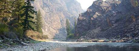
Ray Arnold, a veteran mountain pilot, was in the left seat, I was in the right, Phyllis in the rear seat of the single engine Cessna 206. We were coming from Cascade, had flown over 8,346-foot Chicken Peak and were looking down on two-and-a-half-million acres of the Frank Church–River of No Return Wilderness stretching for miles in all directions. It’s a mountainscape that has always attracted tough men and women. A lonely Eden, and, for some, a garden of agony.

At about three thousand feet, Ray banked the plane steeply and finally put us down on the eight-hundred-foot runway that sits on a sloping meadow above the river crossing called Campbell’s Ferry.

We thanked him, unloaded our twenty-odd boxes of gear and watched as the little plane clawed into the air headed straight for the canyon wall across the river. The plane banked left to find the deep canyon opening downriver, banked again to follow the narrow cut, rounded the bend at Lemhi Point and was gone, leaving only the sound of the Salmon River as it made its way past the historic homestead that would be our home. Continue reading

This content is available for purchase. Please select from available options.
Register & Purchase  Purchase Only

Climbing the Waterfall

Posted on by Mark Weber / Leave a comment

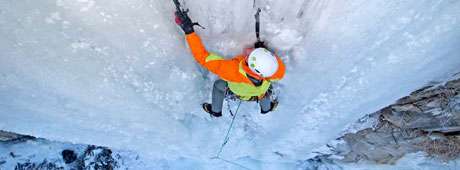
The sheer rock walls of the Snake River Canyon are laced with sinewy waterfalls during temperate months, but with the onset of winter and plummeting temperatures, these delicate cascades freeze. Taking on the form of veined curtains of glass and columns of crystal, this transient world becomes a frozen palace where the ice climber reigns.
For more than two decades I have sought out the bizarre adventures of this fragile kingdom, and I’m not alone in pursuit of it. Other climbers also have been visiting these ice formations for years, and these days I often am accompanied by my son Elijah and various friends, such as longtime climber David Weber, to whom I’m not related except in our passion for climbing ice.

“Ice climbing? It looks crazy to me. Too dangerous. No offense, but I think you are truly insane.”

How many times have I heard that argument from casual observers? And on some level I have to agree. Continue reading

This content is available for purchase. Please select from available options.
Register & Purchase  Purchase Only

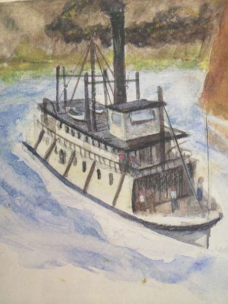
Riverboat, Ahoy

Posted on by Grove Koger / Leave a comment

It’s one of the ironies of Idaho’s geography that our longest river, the Snake, is navigable for only short distances.

Part of the reason is that over the course of its nearly 1,100 miles, the river drops more than 8,500 feet. The other reason is that until recently our grandest natural wonder, Hells Canyon, proved impassable to any vessel attempting a run upstream. But the lowest reaches of the Snake enjoyed busy traffic in the late nineteenth and early twentieth centuries, and for a time riverboats even served the mining trade on the middle Snake. At least one made it as far as the mouth of the Bruneau River.

I’m an Idaho native, but I didn’t grow up particularly close to a river. Instead I had to make do with a small drainage canal that ran through our farm outside Meridian. But it was water, and that was enough. In some way that I couldn’t have explained, water was magical. Years later, when I became a reference librarian at Boise Public Library, I discovered the wealth of information in its Idaho Pamphlet File—clippings about canals and rivers and steamboats and much, much more. Since then I’ve supplemented my reading with such books as Fritz Timmen’s Blow for the Landing and Bill Gulick’s Steamboats on Northwest Rivers. And here’s what I’ve learned. Continue reading

This content is available for purchase. Please select from available options.
Register & Purchase  Purchase Only